
Decatur ZIP Polygons at a Glance
The current Decatur GIS layer shows four city-core ZIP polygons: 62521, 62522, 62523, and 62526. It also shows 62535 in the nearby Forsyth context. That fifth value matters for searches across the wider Decatur and Macon County map, but it is not a Decatur city ZIP. The layer maps polygons and exposes ZIP, post-office name, population, and area fields. It does not turn each polygon into a fixed neighborhood list.
| ZIP | Mapped Decatur context | Service point | Search caution |
|---|---|---|---|
| 62521 | Core city polygon | Verify station by address | Do not assign one neighborhood to the whole area |
| 62522 | Core city polygon | Verify station by address | Postal area can cross the city line |
| 62523 | Central and downtown postal context | Decatur Post Office, 214 N Franklin Street | The station ZIP does not define all of downtown |
| 62526 | Core city polygon with northern and eastern context | Decatur Memorial Station, 1601 E Mound Street | Map and delivery edges may differ |
| 62535 | Adjacent Forsyth polygon | Forsyth Post Office, 300 E Ruehl Street | Nearby Macon context, not a Decatur city ZIP |
The wider GIS service also contains rural and county ZIPs. Keep them out of a city-core list unless a specific address is verified. The official Decatur ZIP polygon layer is the best source for seeing what the local map actually contains.
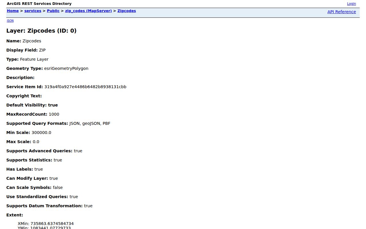
The layer confirms mapped values and geometry, but USPS remains the final source for a delivery assignment at one address.
Map Decatur ZIP Records Together
The Decatur Digital Atlas is the city entry point for address, parcel, street, property, zoning, park, aerial, floodplain, and neighborhood layers. Those layers answer questions that a postal result cannot. A Decatur mailing label may be valid even when the parcel falls outside the municipal boundary, and a named neighborhood may cross a postal polygon.
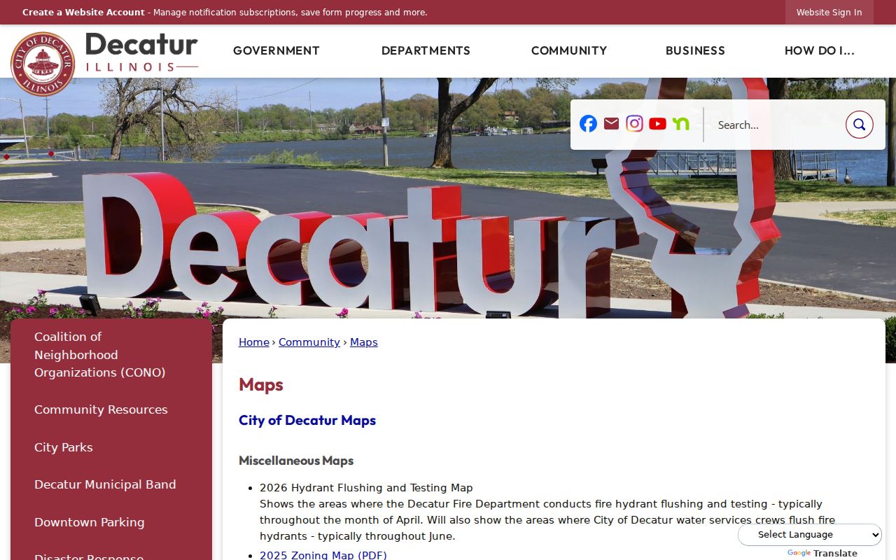
Use the atlas to compare the postal polygon with parcel and city geography. Then save the parcel number or active city address as the stable key for a records search.
This distinction is central to a Decatur ZIP code directory. Postal geography routes mail. The assessor, Recorder, and city GIS rely on parcel, legal description, and mapped address fields. Those systems may describe the same place with different labels because they serve different public tasks.
Old Decatur ZIP Labels Need Dates
Archived USPS and Domestic Mail Manual references contain 62524 and 62525 labels, but those values do not appear among the current Decatur city GIS unique values. They are evidence of route history, not proof of present city coverage. A family letter, old directory, or clipped address may preserve one of these numbers long after the delivery system changed.
Write down the year of the source. Check the full address in today's USPS tool, then compare the street and house number with the city address layer. If the street number changed, use plats, Sanborn maps, legal descriptions, and historical directories. Charles O. Ebel's work numbering homes and installing early street signs is a local reminder that address systems develop over time.
Find Decatur Records Within One ZIP
Macon County GIS is the verified local tool for a ZIP-wide map search. Its parcel mode has a ZIP Code field, and its address mode has a Zip field. The property-tax search does not expose the same ZIP control; its visible fields are parcel, owner, address, use code, sale price, and sale date. The state voter lookup also asks for a five-digit ZIP, but only as part of an individual identity match. It cannot produce a ZIP-wide resident roll.
- Confirm the full street and unit through USPS By Address. Save the standardized city and five-digit result.
- Enter that number in the Macon GIS ZIP field. Turn on the city, parcel, and neighborhood layers needed for context.
- Limit the result with Current map extent when the full polygon is too broad. Select a parcel and record its PIN and situs address.
- Open the county property card by PIN or street address. Read the current owner and mailing address cautiously because neither proves who occupies the home.
- For one named voter, use first name, last name, birth date, and five-digit ZIP in the state registration lookup. Contact the Macon County Clerk after a mismatch.
When a ZIP search narrows the work to a particular road, the Decatur street directory explains the parcel and deed trail at street level. Do not export a map and call it an occupant list. GIS identifies mapped land features and owner-linked parcels, not all people in a home.
Decatur ZIP Search Fields in GIS
The Macon viewer provides more than a single postal box. Its extra filters help distinguish a broad ZIP from one subdivision, township, fire district, or visible map area. Search fields documented in the inspected viewer include the following.
| GIS control | Input | Best Decatur use |
|---|---|---|
| ZIP Code | Five-digit text | Filter parcel-mode results by postal area |
| Zip | Address-mode text | Narrow an address search |
| Street Name | Text | Pair a road with a ZIP |
| Subdivision | Filter | Separate mapped developments |
| Township or Fire District | Mode or dropdown | Compare public boundaries |
| Current map extent | Map control | Limit results to the area on screen |
The viewer also offers map selection, measuring, printing, and CSV export. Use an export as a work list of mapped features, not as a ZIP code resident directory. If the live layer fails to load, return through the county GIS page or call the GIS office rather than guessing the polygon.
Verify Decatur ZIP Codes with USPS
USPS offers three consumer lookup modes. By Address standardizes a specific street and unit. By City & State lists postal associations. Cities by ZIP returns the city or post-office names tied to a number. Only the address mode settles the delivery ZIP for a particular home, and USPS warns that the result does not verify any person or company at that address.
| By Address | Company optional; street, city, and state required; unit and ZIP can narrow the match |
|---|---|
| By City & State | Find postal ZIP associations, not legal city limits |
| Cities by ZIP | Find postal city or post-office names tied to the number |
The USPS ZIP Code basics explain why a mailing place and a legal municipality may not match.
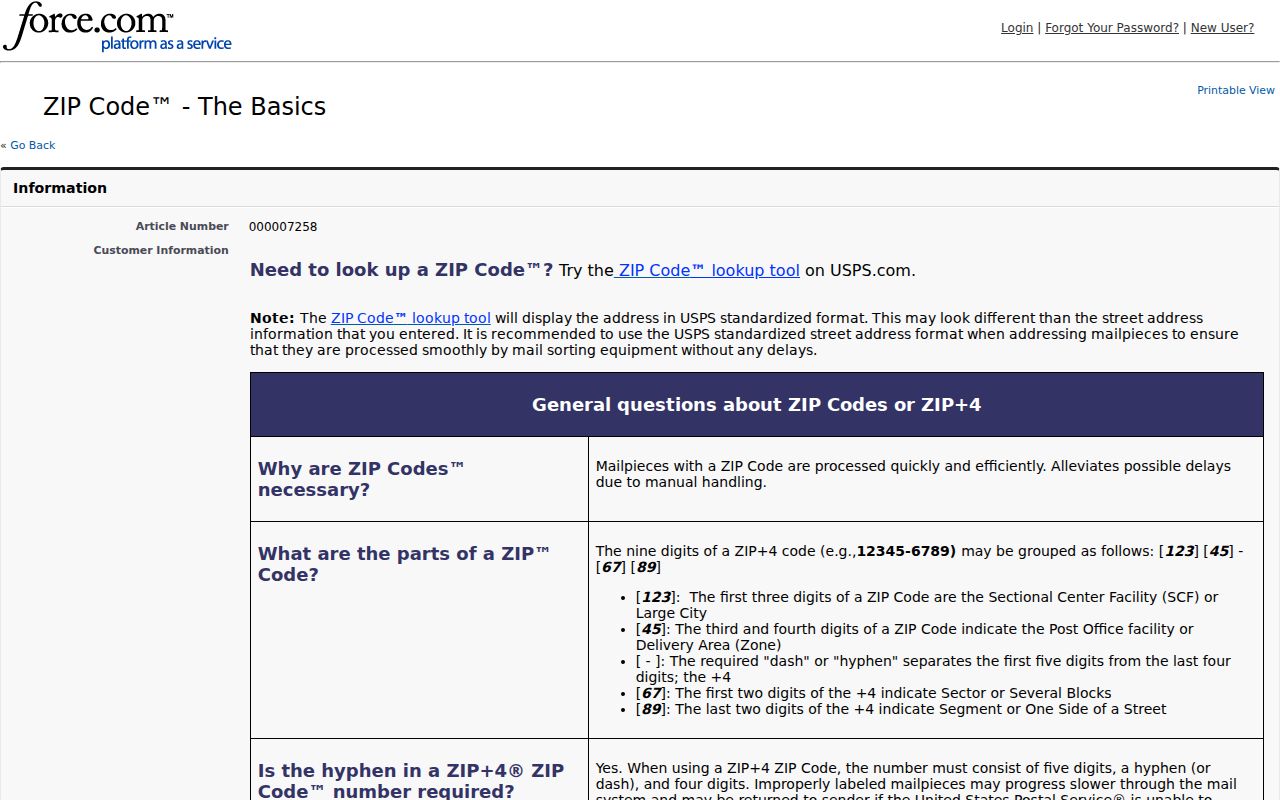
That postal guidance supports the same caution shown by Forsyth: a delivery identity is not a Decatur boundary certificate.
Decatur ZIP Detail in AIS
The PostalPro AIS Viewer adds modes for City and State, Delivery Type, County, Delivery Stats, ZIP+4, and Address Lookup. It updates monthly. This makes it useful when a basic consumer result needs more delivery context, but it is still an address-quality system rather than a list of Decatur residents.
The USPS AIS Viewer presents those postal search modes.
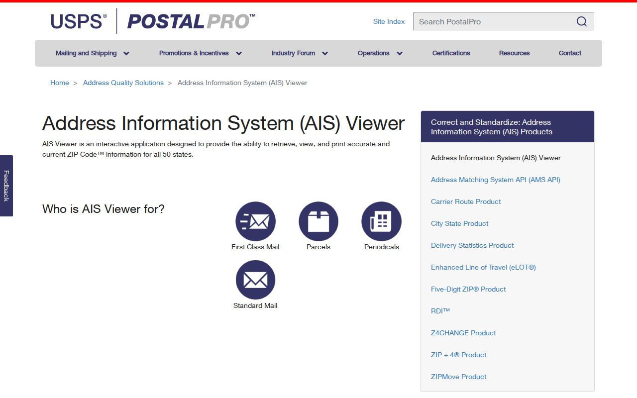
Use AIS to refine delivery facts, then return to Macon GIS for county, parcel, neighborhood, and city-limit context. The two tools answer different parts of the address question.
Decatur ZIP Lines Are Not Limits
62535 is the clearest local example. It appears in the wider Decatur and Macon GIS context, yet its postal city and post office are in Forsyth. Likewise, a “Decatur, IL” mailing label does not prove that the parcel lies within incorporated Decatur. City limits, postal polygons, townships, precincts, and named neighborhoods can overlap without sharing an edge.
- ZIP and ZIP+4
- A five-digit ZIP covers a delivery area. The added four digits narrow a delivery segment, building, or group of addresses.
- PO-box ZIP
- A postal code used for boxes at a post office rather than a mapped set of homes.
- Unique ZIP
- A ZIP assigned to one organization or high-volume receiver. USPS notes that such codes exist, but none should be claimed for Decatur without a verified assignment.
- Carrier route
- A group of delivery points served on one route. It does not equal a neighborhood or city district.
Match the question to the keeper. USPS answers delivery. City and county GIS answer mapped location. The assessor answers the situs, which means the parcel's physical address, and mailing address on the tax card. The Recorder answers the legal description in a deed or plat. One ZIP code cannot replace those record keys.
New Decatur Addresses Take Time
Local government assigns a new street address before USPS adds it to postal systems. USPS says to allow about five to seven business days after local creation for the address to appear. That delay can explain why a valid new Decatur location appears in GIS but fails in a postal lookup.
The USPS new-address guidance describes the handoff from local assignment to postal reporting.
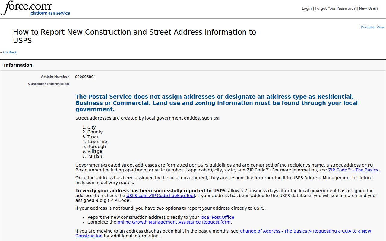
For a recent Decatur address, verify the city address point and parcel first, wait through the reporting window, and try USPS again. Avoid treating a temporary non-match as proof that the location does not exist.